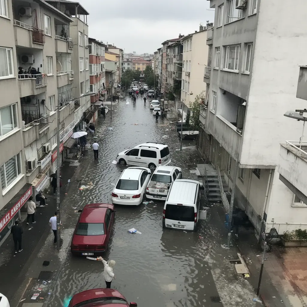
AI-Powered Flood Risk Map Reveals Istanbul’s Most Vulnerable Districts
Istanbul, March 25 – Istanbul Technical University (İTÜ) has unveiled an artificial intelligence-powered flood risk map for the megacity. The comprehensive study, released today, identifies Fatih, Gaziosmanpaşa, and Bağcılar as among the districts most susceptible to flooding. This initiative aims to provide critical data for urban planning and disaster preparedness in one of the world’s most populous cities.
High-Risk Areas Identified by AI
The AI-driven analysis, conducted by İTÜ’s Institute of Disaster Management, highlights specific areas across both the European and Anatolian sides of Istanbul. According to Associate Professor Dr. Ömer Ekmekcioğlu from the Institute, districts with high population density are particularly vulnerable.
“When we look at regions with high population density in Istanbul, such as Esenler, Güngören, and Bağcılar, we can observe a high flood risk. Fatih is also an example of this,” stated Dr. Ekmekcioğlu. He further elaborated on the Anatolian side, noting that “districts like Üsküdar, Ümraniye, Ataşehir, and Kadıköy also face high flood risk.”
The study categorizes Istanbul’s surface area into different risk levels:
- High Risk: Approximately 10% of Istanbul’s surface area.
- Medium Risk: Approximately 10% of Istanbul’s surface area.
- Low to Very Low Risk: Approximately 80% of Istanbul’s surface area.
Dr. Ekmekcioğlu emphasized the critical nature of the 10% high-risk areas, noting that “this area also hosts a very significant population density. Flood risk increases in these regions due to the impact of population density.”
Detailed District Risk Ranking
The İTÜ study provides a detailed ranking of Istanbul’s districts based on their flood risk values, with higher values indicating greater risk:
| Rank | District | Risk Value |
|---|---|---|
| 1 | Fatih | 0.7750 |
| 2 | Gaziosmanpaşa | 0.7505 |
| 3 | Bağcılar | 0.7340 |
| 4 | Güngören | 0.7305 |
| 5 | Beyoğlu | 0.7211 |
| 6 | Bahçelievler | 0.7109 |
| 7 | Bayrampaşa | 0.7093 |
| 8 | Zeytinburnu | 0.6812 |
| 9 | Esenler | 0.6616 |
| 10 | Kağıthane | 0.6516 |
| 11 | Şişli | 0.6392 |
| 12 | Esenyurt | 0.6142 |
| 13 | Küçükçekmece | 0.5816 |
| 14 | Kadıköy | 0.5615 |
| 15 | Ataşehir | 0.5366 |
| 16 | Ümraniye | 0.5339 |
| 17 | Üsküdar | 0.5297 |
| 18 | Bakırköy | 0.4818 |
| 19 | Sultanbeyli | 0.4576 |
| 20 | Sultangazi | 0.4542 |
| 21 | Kartal | 0.4478 |
| 22 | Beşiktaş | 0.4301 |
| 23 | Avcılar | 0.4090 |
| 24 | Beylikdüzü | 0.3983 |
| 25 | Sancaktepe | 0.3941 |
| 26 | Maltepe | 0.3803 |
| 27 | Pendik | 0.2895 |
| 28 | Başakşehir | 0.2880 |
| 29 | Arnavutköy | 0.2877 |
| 30 | Tuzla | 0.2865 |
| 31 | Büyükçekmece | 0.2821 |
| 32 | Eyüpsultan | 0.2685 |
| 33 | Çatalca | 0.2371 |
| 34 | Beykoz | 0.2338 |
| 35 | Çekmeköy | 0.2212 |
| 36 | Sarıyer | 0.1880 |
| 37 | Silivri | 0.1831 |
| 38 | Şile | 0.1377 |
| 39 | Adalar | 0.1376 |
Implications for Urban Planning and Disaster Management
The findings from this AI-powered flood risk map are expected to be instrumental for Istanbul’s municipal authorities in developing more effective urban planning strategies and disaster management protocols. By pinpointing the most vulnerable areas, resources can be allocated more efficiently to mitigate flood risks and protect residents. This includes potential infrastructure improvements, early warning systems, and public awareness campaigns in the identified high-risk districts.
The use of artificial intelligence in this study marks a significant advancement in disaster preparedness for megacities, offering a data-driven approach to understanding and addressing environmental challenges. The detailed risk assessment provides a scientific basis for future interventions aimed at enhancing the resilience of Istanbul against natural disasters.
Source: Sabah.com.tr


